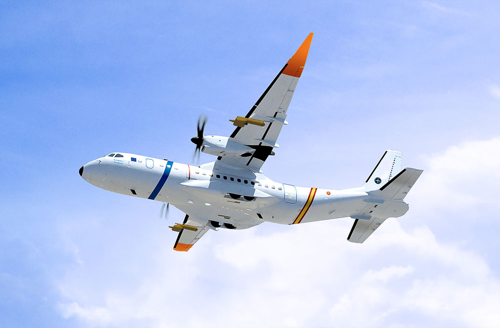
New PAI C-295

This action is co-financed by the European Regional Development Fund (ERDF) through the Pluri-regional Operational Program of Spain 2014-2020 in the framework of the call for public Scientific-Technological Initiatives of the CDTI.
Brief description of the performance:
- Objetive: Provide the Department of Aerial Platforms of INTA with a C-295MW aircraft
- Place of execution: Autonomous Community of Andalusia
- Execution time: July 15, 2023
- Budget: 27,500,000 €
- CDTI and FEDER co-financing. Financing for a maximum amount of 100% of the total eligible project budget. At least 80% of said total budget (22.000.000€) will be financed from the FEDER funds of the Pluriregional Operational Program (POPE) 2014-2022
The PAI Platform is a large infrastructure designed for the acquisition of data from an aerial platform for multiple scientific applications.
Provide support to the needs of the communities for aircraft flight testing, atmospheric research, remote sensing/Earth observation data collection, development testing, training and education of both flight and scientific crews and qualification of new scientific instrumentation, among others.
The infrastructure is also available, to offer advanced training to future researchers in the field of Earth Sciences whose studies require geospatial data acquired from aerial platform: agriculture, geology, atmosphere, continental waters, marine environment, etc.
The C-295MW aircraft is equipped with FTI systems and atmospheric probes in order to respond to the demands of customers who require an instrumented platform to carry out remote sensing studies, prototype development, atmospheric studies and other science-related activities aeronautics.
The data obtained by PAI instrumentation are often unique and complex due to their format, structure, measured variable, measurement technique, etc. The PAI team offers users the necessary support to exploit and interpret the generated products, and extract useful information from them.
The main areas of action of the PAI are explained in greater detail below:
-
Flight testing
The c-295MW aircraft is equipped with the appropriate instrumentation and human resources to carry out flight tests of aerospace equipment or systems, once their compatibility with the aircraft has been analyzed and within the established safety margins. The PAI team will collect and interpret the needs transmitted by the users, will plan, prepare and execute the test flights, and will support the users in the analysis and interpretation of the data acquired.
-
Atmospheric research
INTA's atmospheric instrumentation and research group focuses its activities on the study of the physics and chemistry of the atmosphere in order to deepen our knowledge of this terrestrial environment. In this area, PAI has been configured as an aerial experimentation laboratory that allows the development of new instrumentation to measure and characterize atmospheric phenomena. Instrumentation available in the market is usually combined with own developments, according to the needs and requirements of each project. The area in which the activity is most intense is the study of changes in the composition of the atmosphere. The data obtained by the aerial platform will be integrated with others obtained in observatories deployed at different points on Earth in mid-latitudes, subtropics and in Antarctica, which operate continuously, recording data on ozone concentration and the species linked to it.
-
Remote sensing with aerial sensors
Carrying out campaigns to obtain remote sensing data with on-board sensors to obtain images, mostly within the framework of environmental applications.
-
Developments of new technologies
The PAI provides the appropriate means for the development and implementation of new technologies for specific aeronautical use and application to other areas. In particular, one of the technologies that is intended to be evaluated throughout its life cycle is the aircraft structural health measurement (SHM), that is, a technology based on fiber optic sensors developed by INTA, which allows to know in real time and deferred the state of the structural health of the aircraft. The type of sensors allows to know the structural state of the platform throughout its life cycle and the working method, once validated, can be applied to other aircraft and structures not only in the aeronautical field (ships, bridges, etc.)
-
Technical assistance
Additionally, through the PAI, technical assistance is offered to carry out those research projects that require an aerial platform to obtain data. The support can include the design of the flights and their execution, and if necessary, the advice of the technical and scientific groups of the Institute with competence in the specialty in question, also promoting, if appropriate, collaboration with external scientific groups. who share the same interests, through national and international communities.


