INTA SAR Calibration Field
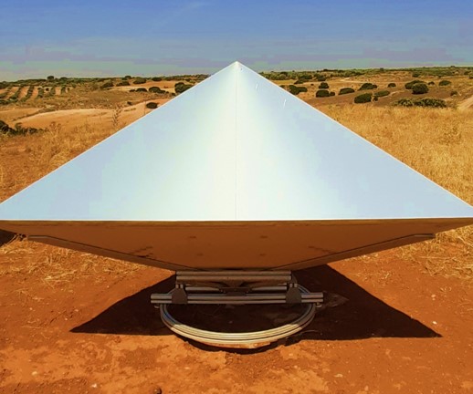
A SAR (Synthetic Aperture Radar) calibration field is a facility or specific area designed for testing and calibrating synthetic aperture radar systems. These fields are controlled environments where experiments can be conducted to assess and fine-tune the accuracy, sensitivity, and performance of SAR systems. SAR calibration fields are typically equipped with known reference targets such as corner reflectors which can be used to evaluate and adjust the radar's calibration parameters. These reference targets emulate the ideal or standard conditions used to calibrate the SAR system and ensure its proper operation.
Calibration is crucial in SAR systems to ensure accurate and reliable measurements of the information captured by the radar. SAR calibration fields provide a controlled and known environment where systematic tests can be conducted to maintain data quality and improve the interpretation of images obtained by synthetic aperture radar.
INTA calibration field was established to cover the external calibration and monitoring needs of PAZ mission, the X-band SAR of the Spanish National Program for Earth Observation, launched in February 2018. Since its beginnings at the end of 2017, over 30 corner reflectors (CRs) have been deployed on the Iberian Peninsula, Spain, at two main sites: Madrid and Albacete. CRs are strategically grouped to accomodate different PAZ image modes, with two sets of reflectors closer together for Spot modes, and other reflectors arranged in a more suitable configuration for Stripmap and ScanSAR modes.
After over 5 years using the calibration field for SAR images, this website is an initiative of the Space SAR Systems and Calibration Group to promote the INTA calibration field and the projects and collaborations stemming from it, whether related to the PAZ mission or other missions requiring its services.

SAR Calibration Field Map
Corner Reflectors
The field comprises up to 40 passive trihedral corner reflectors manufactured in different batches: 19 CRs of 1.0m inner leg size and 21 CRs of 1.5m inner leg size, suitable for use with X-band radars, such as the PAZ sensor:
 |
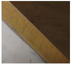
First batch [CR01 to CR06]: 3CRs 1.0m leg size & 3CRs 1.5m leg size 0.7 mm thick both aluminum plates. 14.6 cm honeycomb insulation core. 1.5 cm drainage hole
|
 |
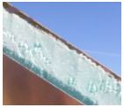
Second batch [CR07 to CR22]: 7CRs 1.0m leg size & 9CRs 1.5m leg size 2/1 mm (internal / external) thick aluminum plates 13 cm thick expanded polyethylene core 1.5 cm drainage hole
|
 |
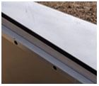
Third batch [CR23 to CR40]: 9CRs 1.0m leg size & 9CRs 1.5m leg size.
2/1 mm (internal / external) thick aluminum plates 13 cm thick reticular polyethylene foam 1.5 cm drainage hole |
Prior their deployment in the field, a 3D CAD model of each of the 40 reflectors manufactured to date was created, enabling the simulation of Radar Cross-Section (RCS) of all of them at the PAZ working frequency, 9.6GH.
All deployed CRs have been carefully located on the ground, selecting areas with regular orography, homogeneous terrain and away from elements that could interfere with the radar signal return to the satellite, so as to guarantee adequate values of Signal Clutter Ratio (SCR) for their location in the image. CRs are mounted on a rotary base, allowing for adjustments in orientation and elevation to realign them as needed for monitoring and calibration of SAR sensors. Most of them are now fixed and just aligned for one overpass, whether ascending or descending, to meet monitoring requirements.
The convention regarding azimuth and elevation angles during deployment is as follows:
INTA corner reflectors have been accurately surveyed by RTK-GPS method, ensuring coordinate accuracies of them has been transformed from local Spanish reference frame, ETRF2000 epoch 2015.0 to the international ITRF2020, since November 2022, taking the survey epoch for each corner. The transformation has been carried out using the conventional geodynamic models that are part of the ITRF definitions, removing plate shifts at survey time. For more information, see IERS conventions.
CR information download
General information on the Space SAR Systems and Calibration Group as well as the list of SAR reflectors in use, can be downloaded from the following links:

![]() Space SAR Systems and Calibration Group
Space SAR Systems and Calibration Group
For further information on the deployed reflectors, including precise coordinates for target positions, alignment angles and status, as well as for any request related to ad-hoc campaigns, please contact us.
Contact
Nuria Casal Vázquez – casalvn@inta.es - 0034 915 201 699
Patricia Cifuentes Revenga – pcifrev@inta.es – 0034 915 201 895
Juan Manuel Cuerda Muñoz – cuerdamjm@inta.es – 0034 915 201 703
CEIT-Space Center INTA Torrejón
Carretera de Ajalvir, km4, 28850. Torrejón de Ardoz.
Madrid, Spain
https://www.inta.es/paz-ciencia/en/
